My spouse Sara and I are section hiking the New England Trail using public transit. There are some areas that require overnights due to the distance between public transit stops, but most can be done as day hikes.
Here are the sections I’ve gotten to with information about public transit options. Click the “Full post” links for a detailed description with photos.
Massachusetts
MA Sections 17 to 19 have no close public transit access.
My spouse Sara and I are section hiking the New England Trail using public transit. There are some areas that require overnights due to the distance between public transit stops, but most can be done as day hikes.
A plethora of delicate mushrooms scattered amongst a lush carpet of moss.
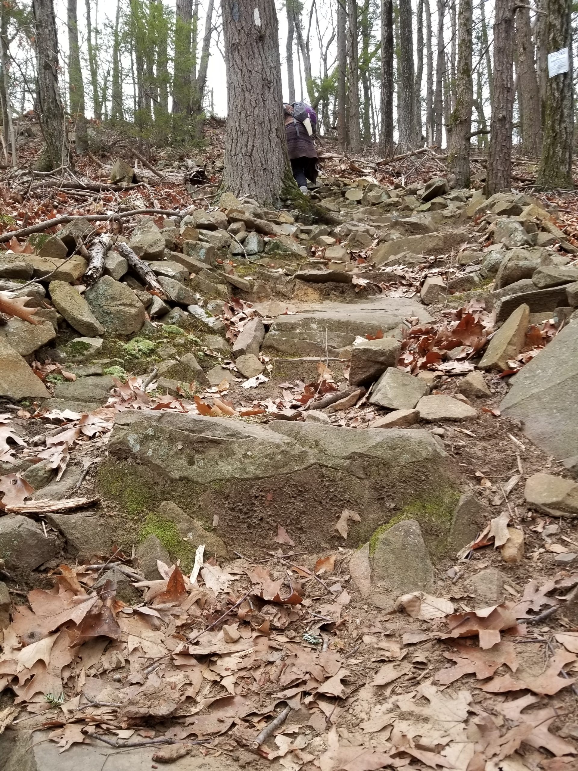
Hike difficulty: Moderate – some steep climbs, long distance.
Approach difficulty: Moderate – crossing two busy highways and navigating a narrow underpass.
Distance: 7.5 miles (7.8 miles with approaches)
Transit:PVTA B23 (schedule, weekdays only) from the Holyoke Transportion Center (HTC) or Holyoke Community College (HCC) & R10 (schedule) from Springfield Union Station. Route G73E provides trips every half hour from Northampton’s Academy of Music to Springfield Union Station. B48 provides service from Northampton to the HTC, R41 provides service from Northampton to HCC, and P21E provides service from Springfield Union Station to HTC. Use the transit directions below for directions from where you live.
Directions to the northern end: Take the B23 to the Westfield / Apremont (Flag Stop) – Stop 5053 (transit directions), walk 0.3 miles west of Route 202 to the trailhead (walking directions). Be careful crossing Route 202.
At the southern end, the bus stop is just to the east of the trail right after you cross Route 20 (transit directions). Be careful going under the railroad underpass on Old Westfield Road and crossing Route 20.
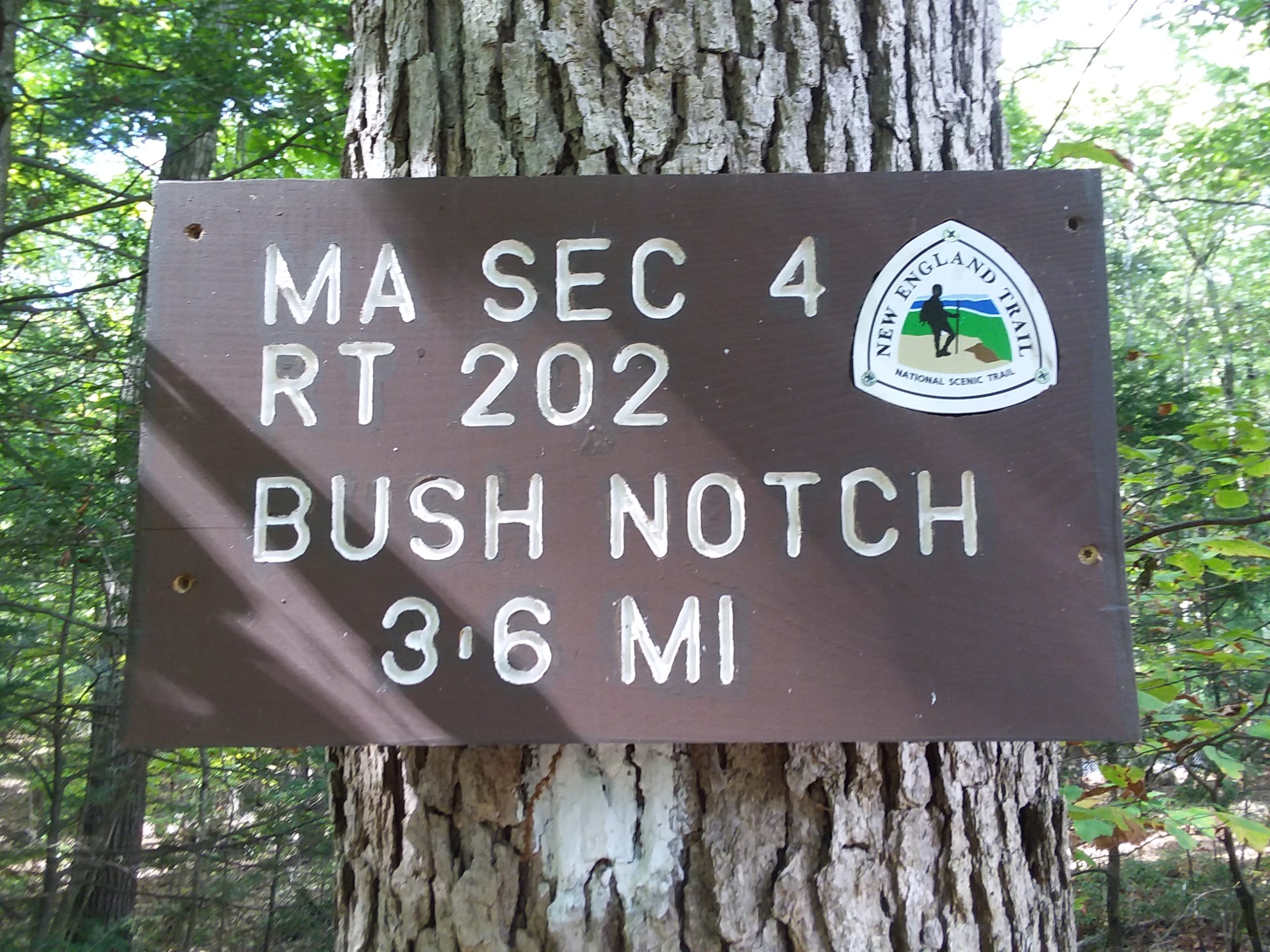
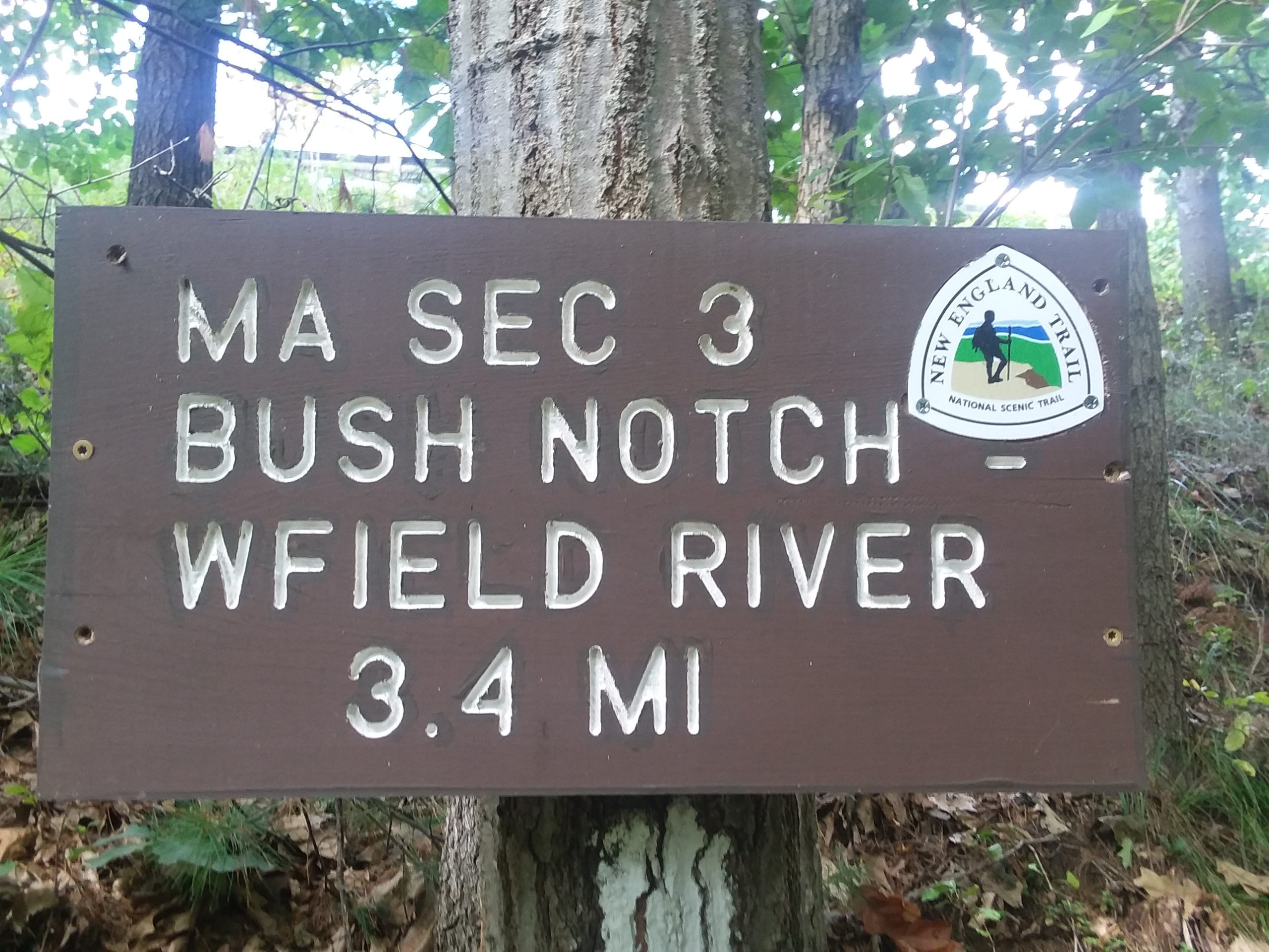
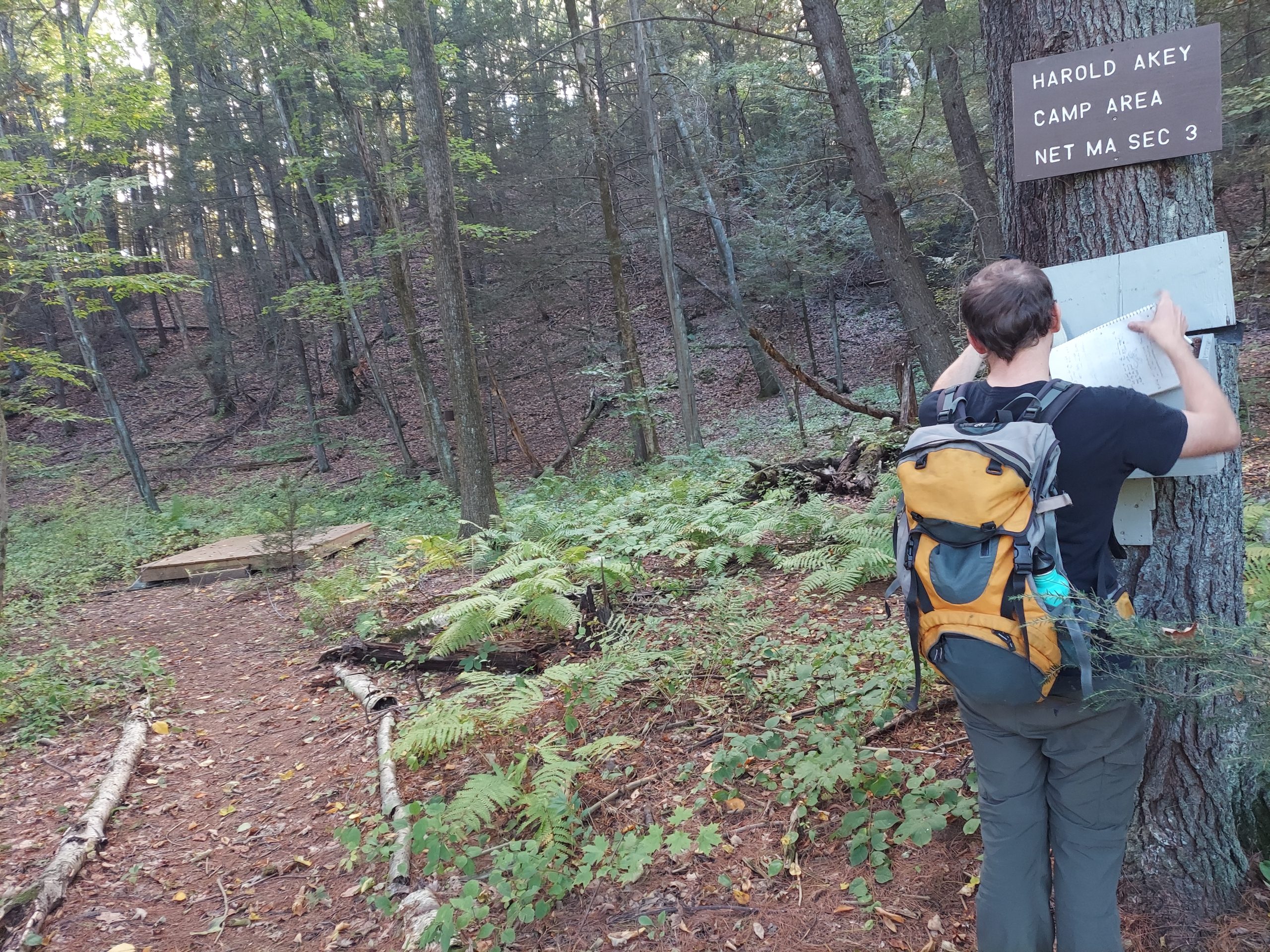
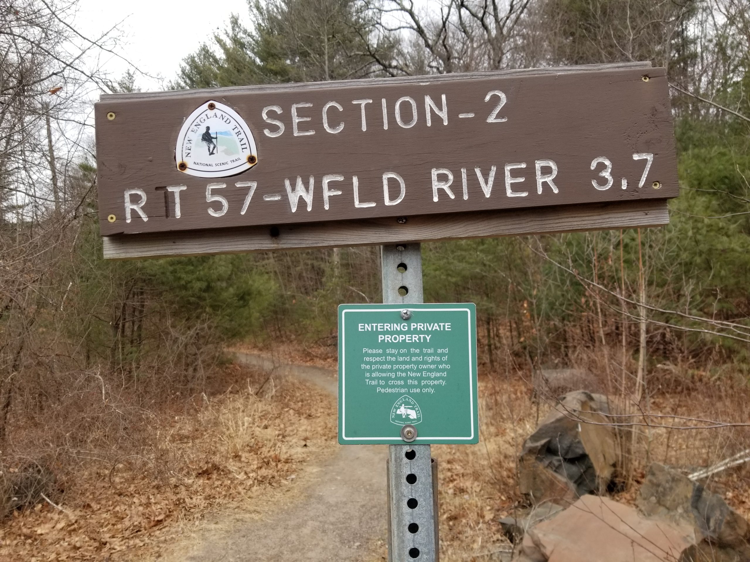
Section 4 runs from Route 202 to the I-90 underpass.
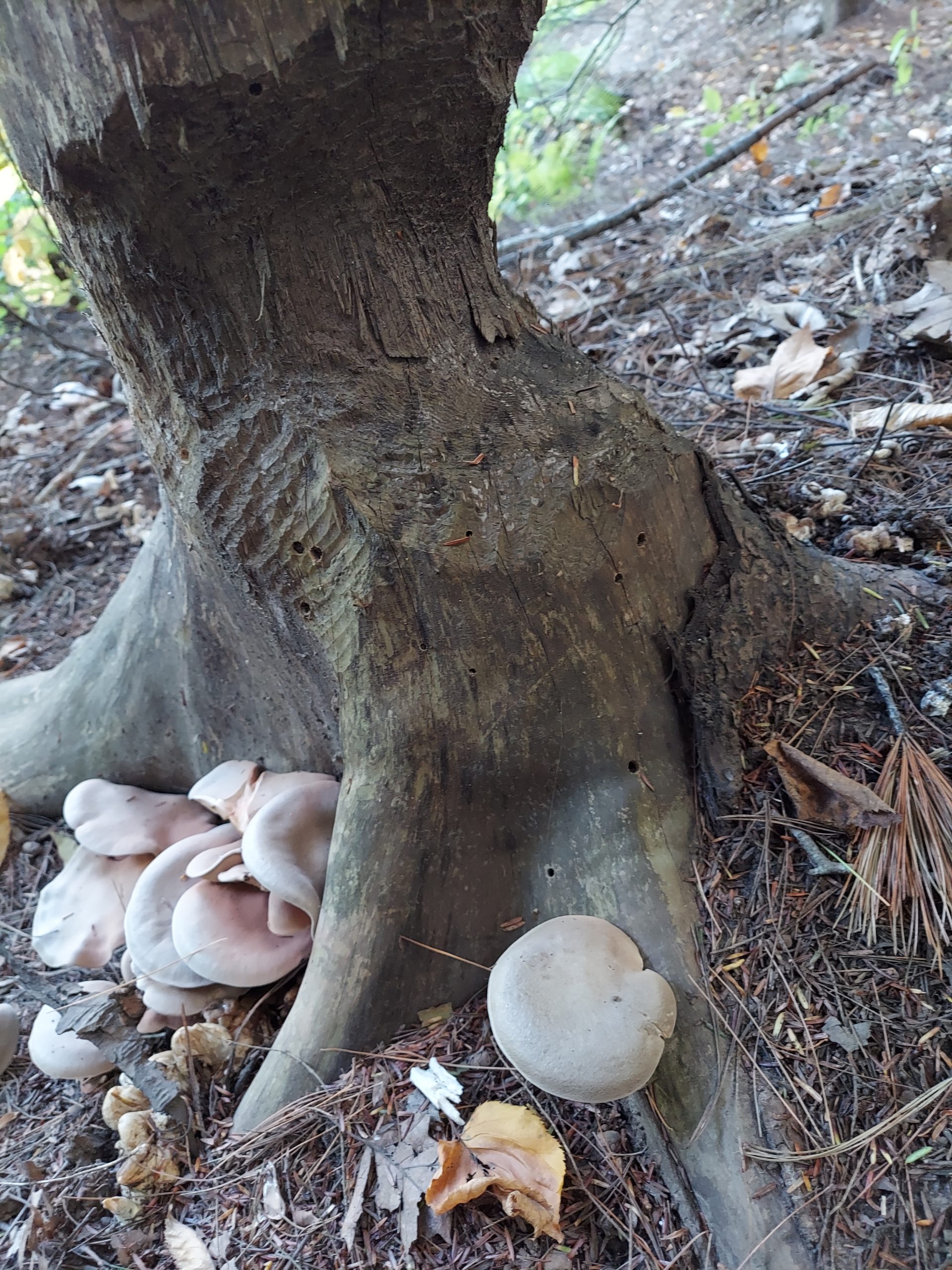
Our timing (late September) was perfect for amazing flushes of mushrooms. Here, a gilled mushroom with umbro stands above the duff.
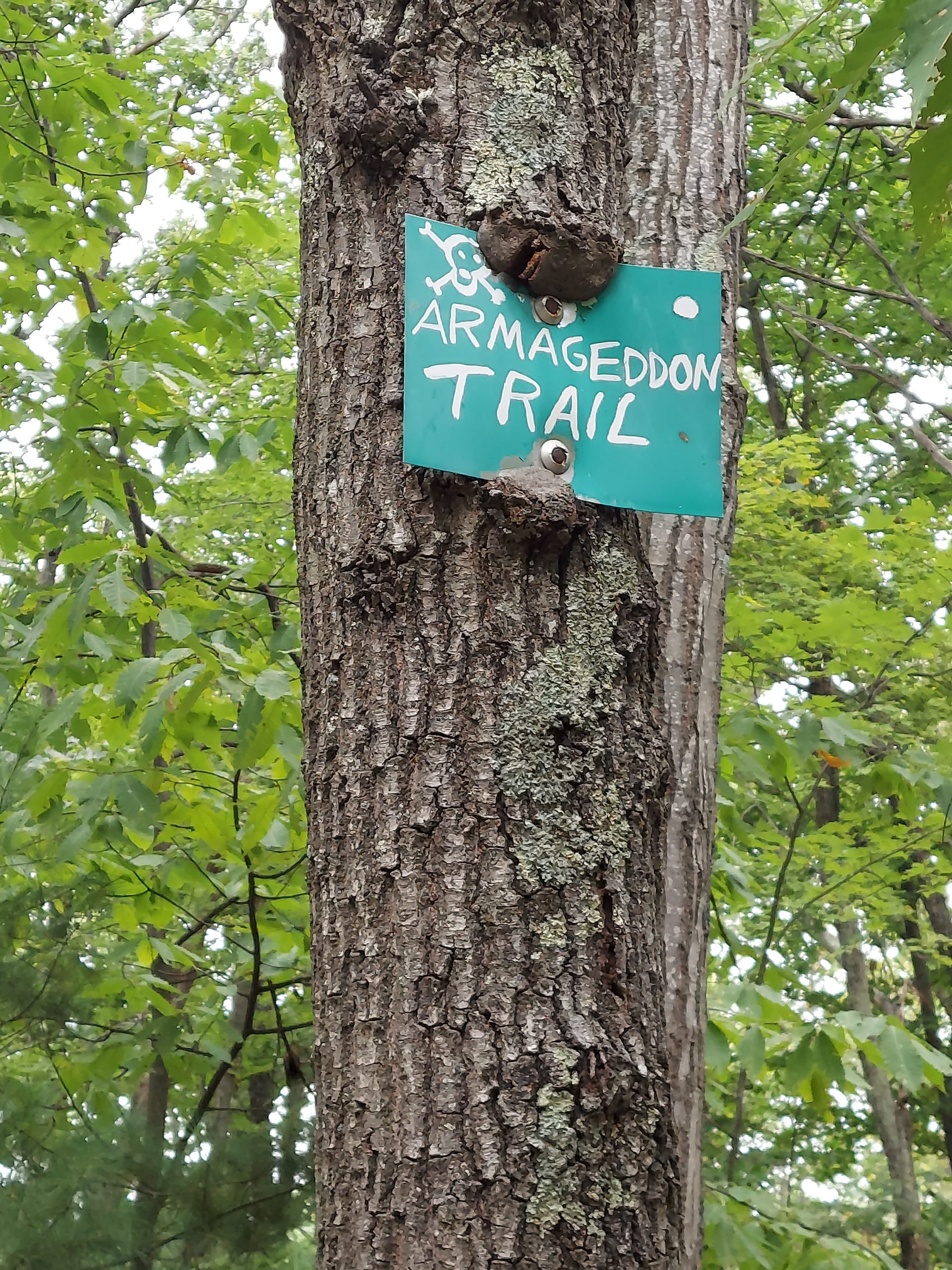
A hand painted sign reading “Armageddon Trail” with skull and crossbones. The tree has begun to grow around the sign. In the background, the leaves on the living trees are still vibrant green.
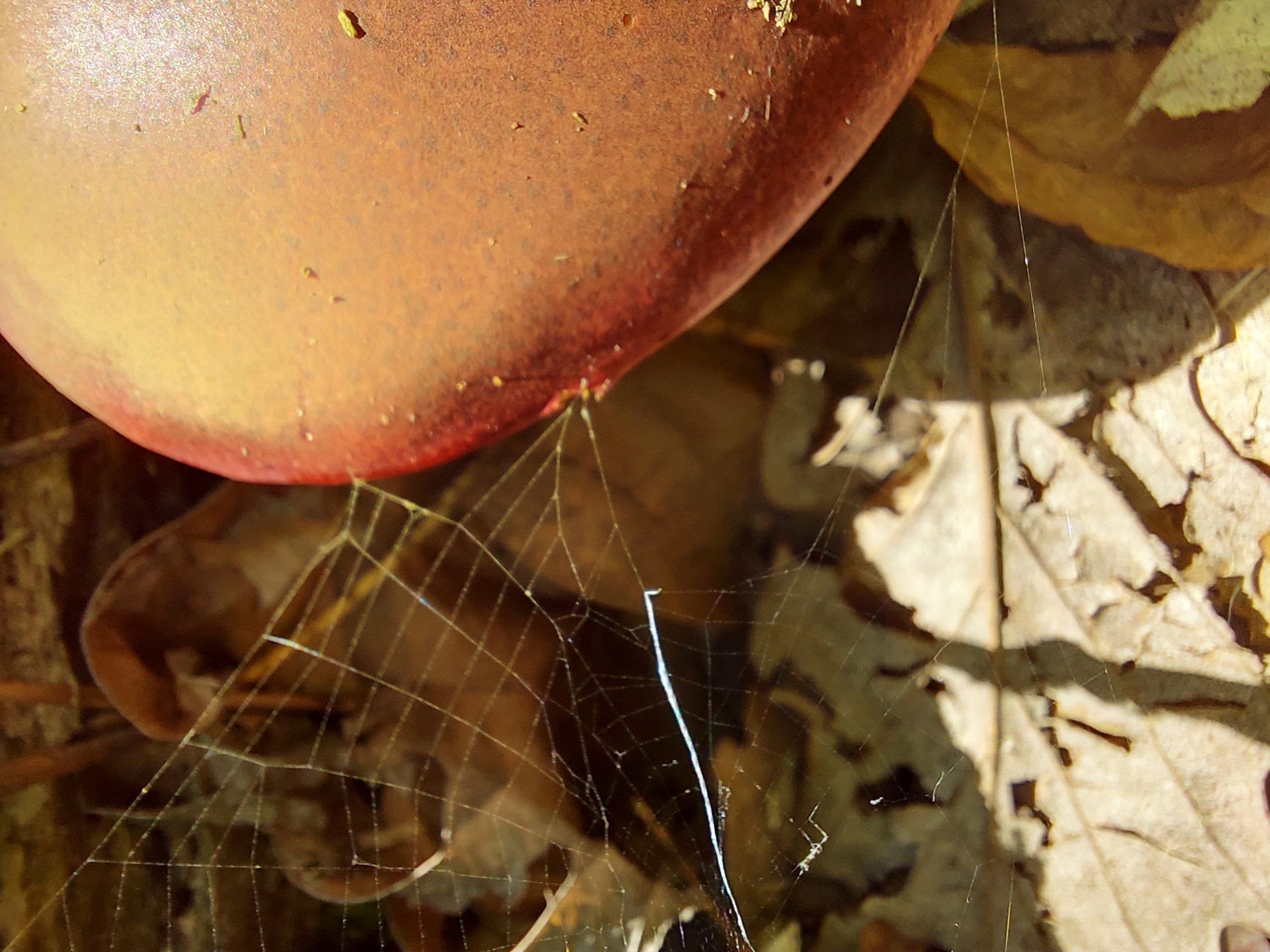
A luscious mushroom cap with sunlight pouring through a spider web.
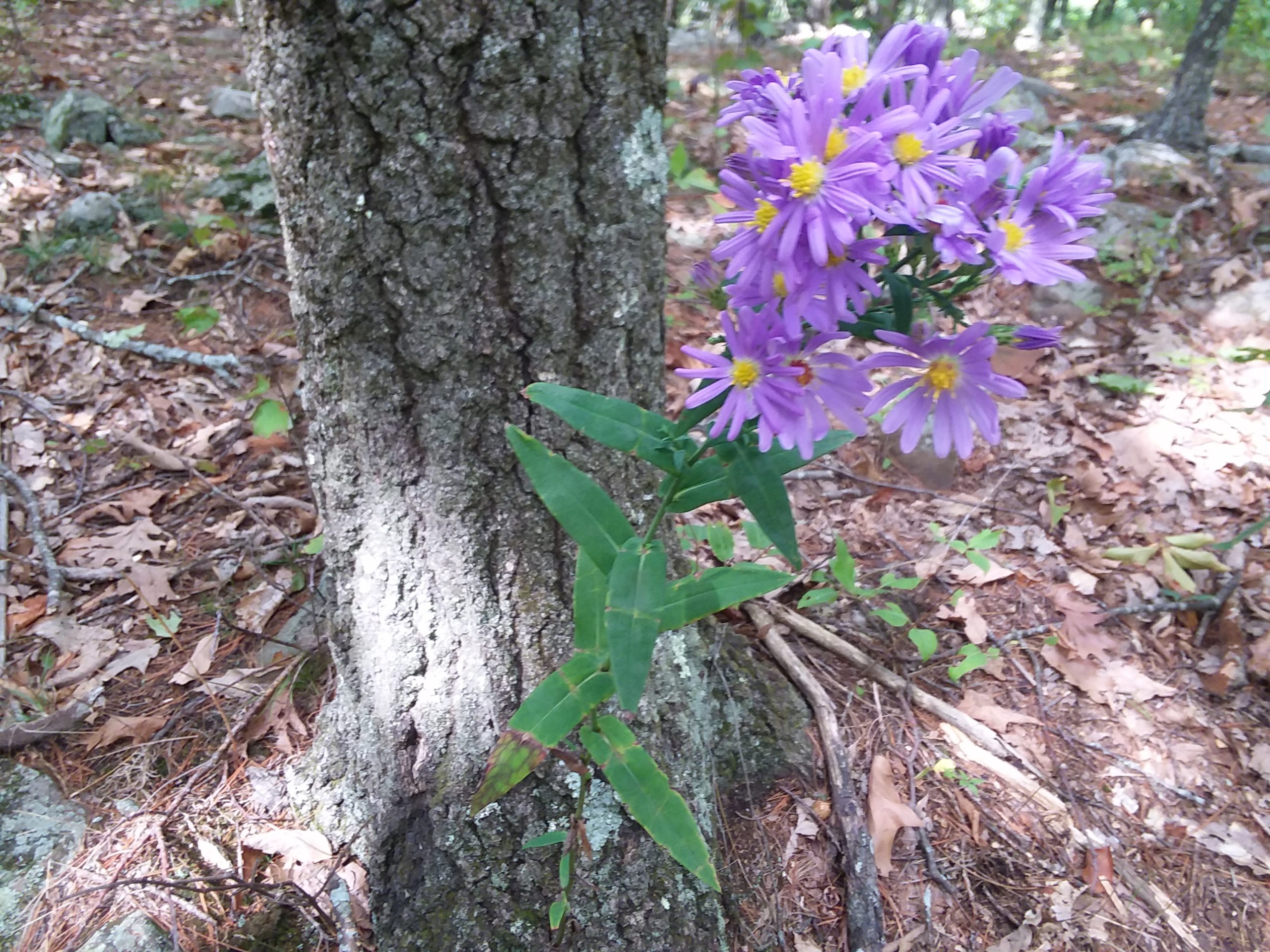
Purple aster at the base of an oak of some kind (we are guessing).
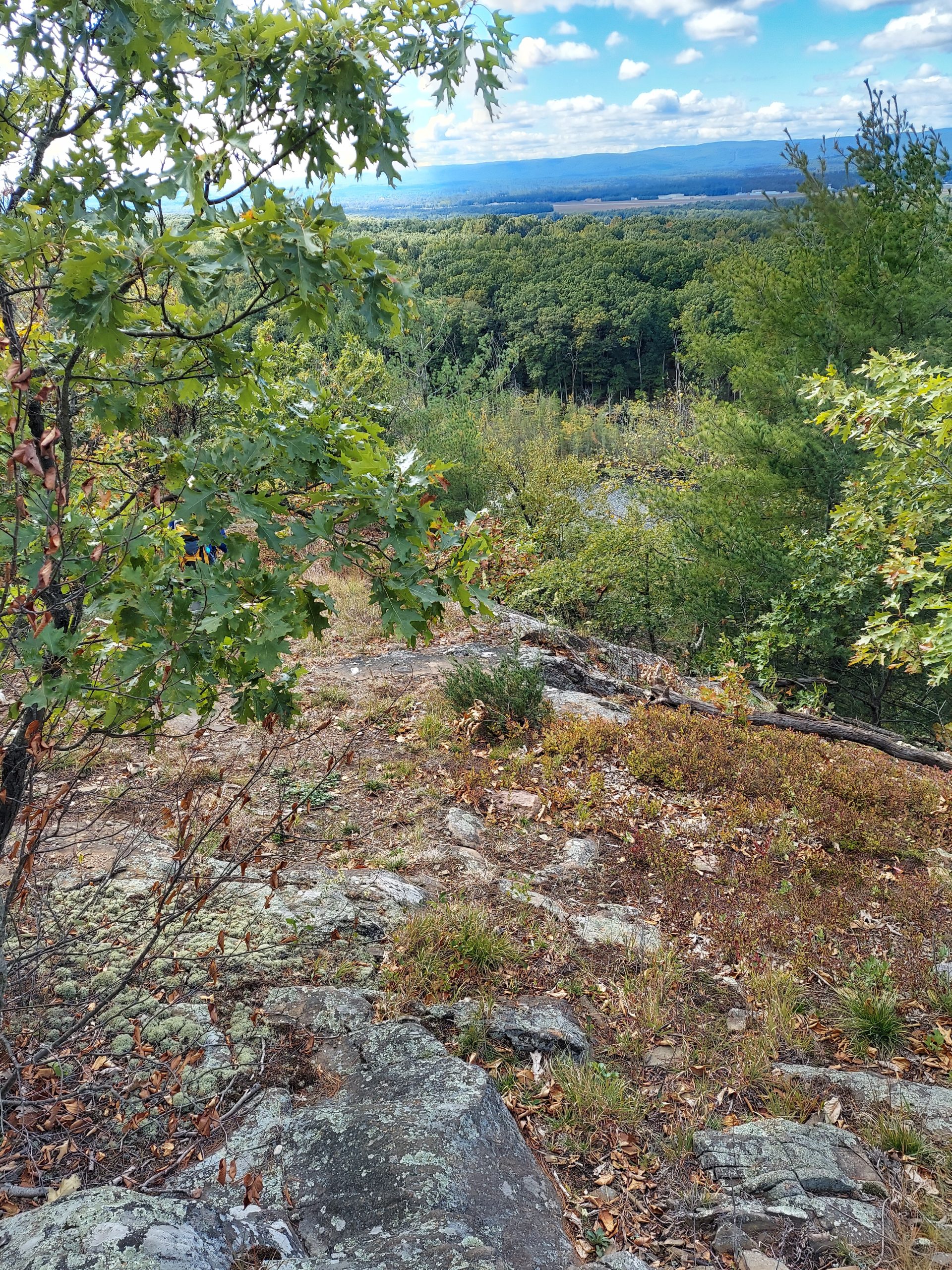
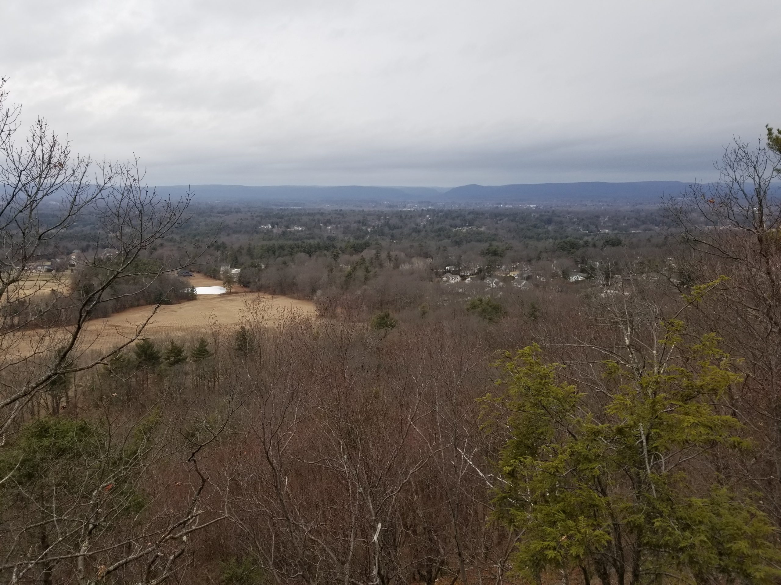
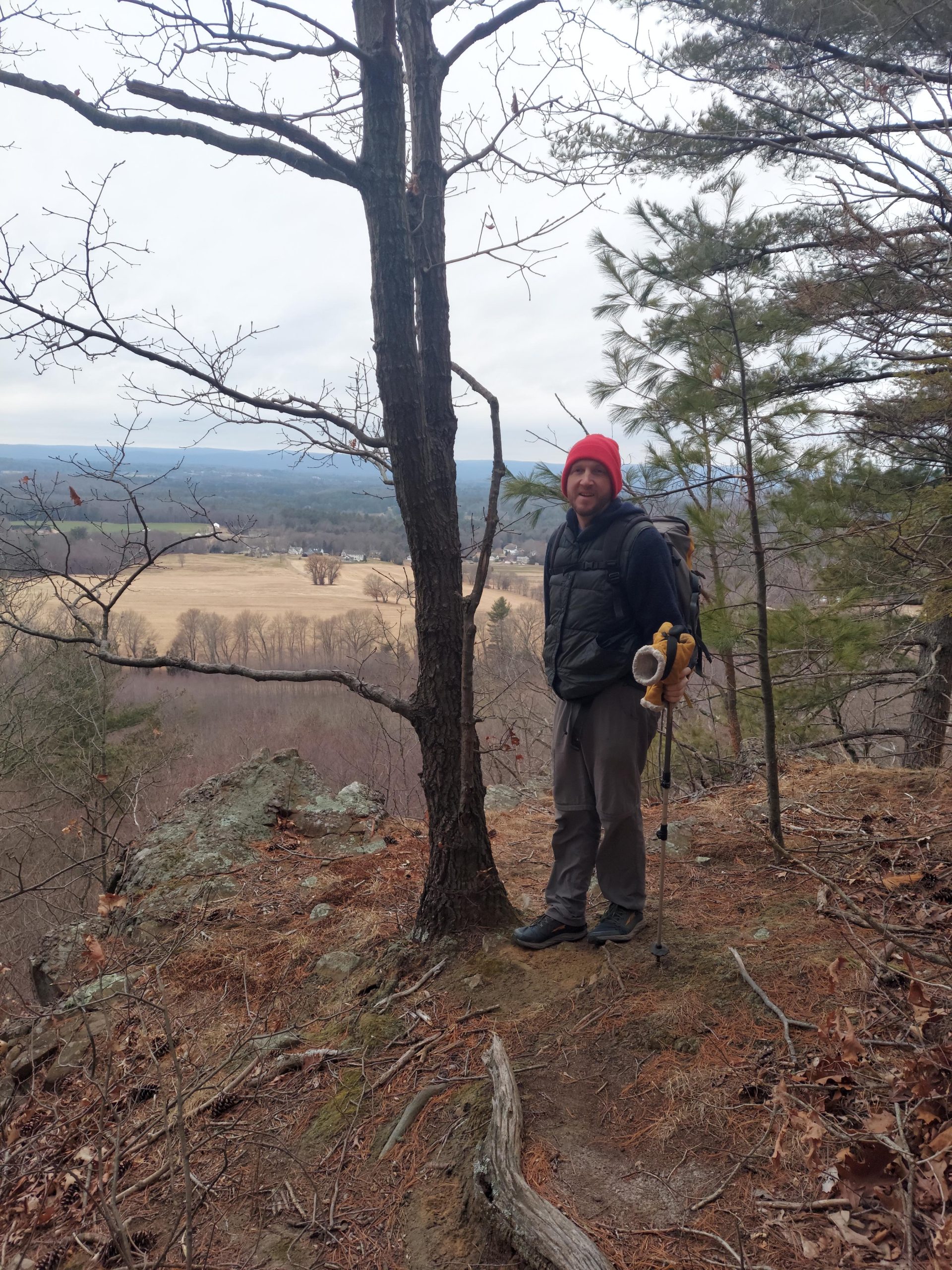
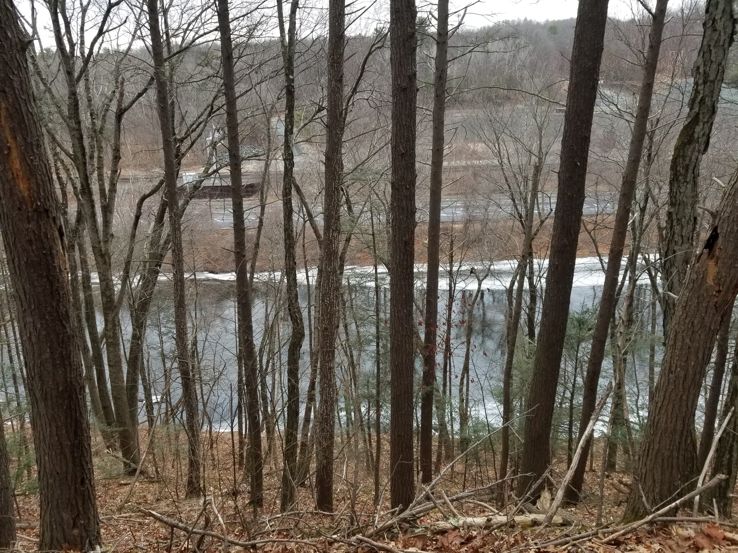
One of the many views along East Mountain.
A gorgeous yellowish-gold coral mushroom nestled in the dry leaves.
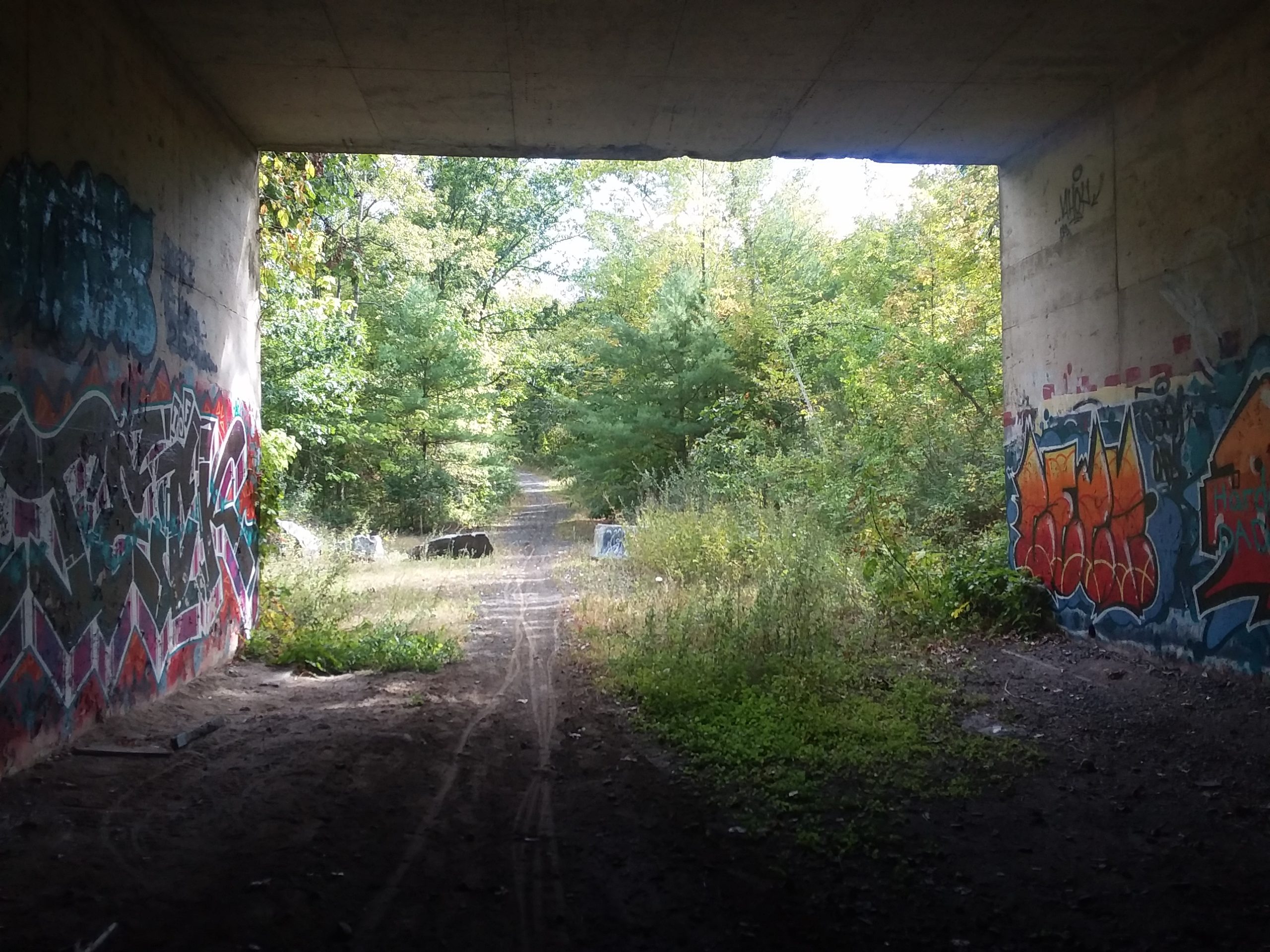
Emerging from the MassPike (I-90) underpass.
The guardrail of the MassPike is visible at the top as Section 3 begins at Bush Notch.
My spouse Sara and I are section hiking the New England Trail using public transit. There are some areas that require overnights due to the distance between public transit stops, but most can be done as day hikes.
Last month we hiked Massachusetts Section 2, which is in the towns of Agawam, Southwick and Westfield.
Hike difficulty: Moderate – two steep climbs, otherwise mostly flat.
Approach difficulty: Hard – walking along highways with heavy traffic without sidewalks for much of the way. At the north end, in times of low water, the Westfield River can be forded and there is a transit stop right on the other side of the river.
Distance: 3.5 to 4.1 miles (6.9 to 7.5 miles with approaches)
Transit:PVTA R14 (schedule) & R10 (schedule) from Springfield Union Station. Route G73E provides trips every half hour from Northampton’s Academy of Music to Springfield Union Station.
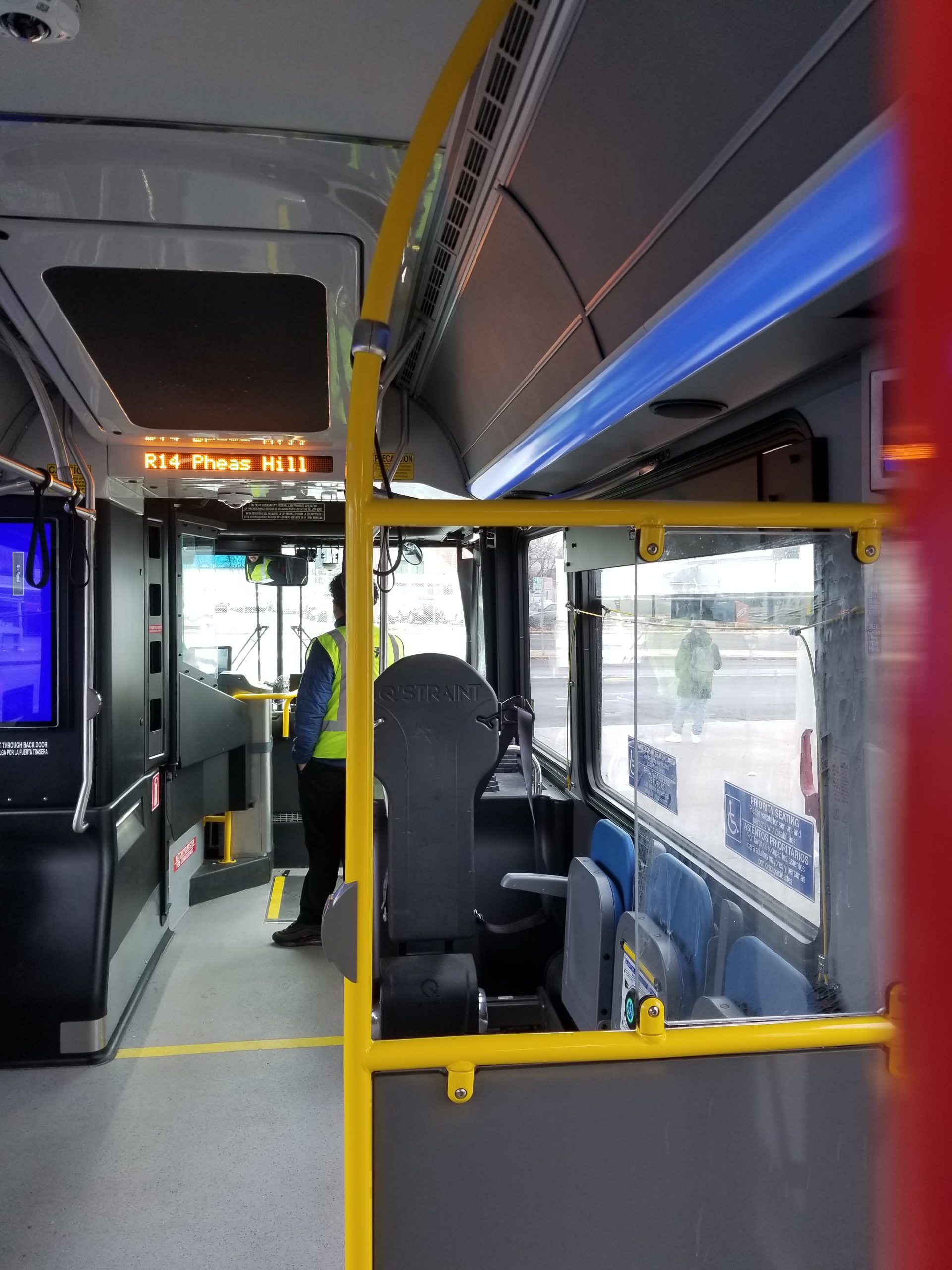
On the PVTA’s R14 bus to the end of the line, Pheasant Hill Apartments.
Directions to the southern end: Take the R14 to Pheasant Hill Apartments (transit directions), walk 1.2 miles on S. West Street to Rt. 57 to the trailhead (walking directions).
At the northern end, walk 2.2 miles on Feeding Hills Rd to Little River Rd to Rt. 20 to the bus stop in front of Chipotle (walking directions). Or if the Westfield River is low, you can ford the river and catch the R10 bus back to Springfield Union Station at Westfield Street (Rt. 20) and Old Westfield Road (transit directions).
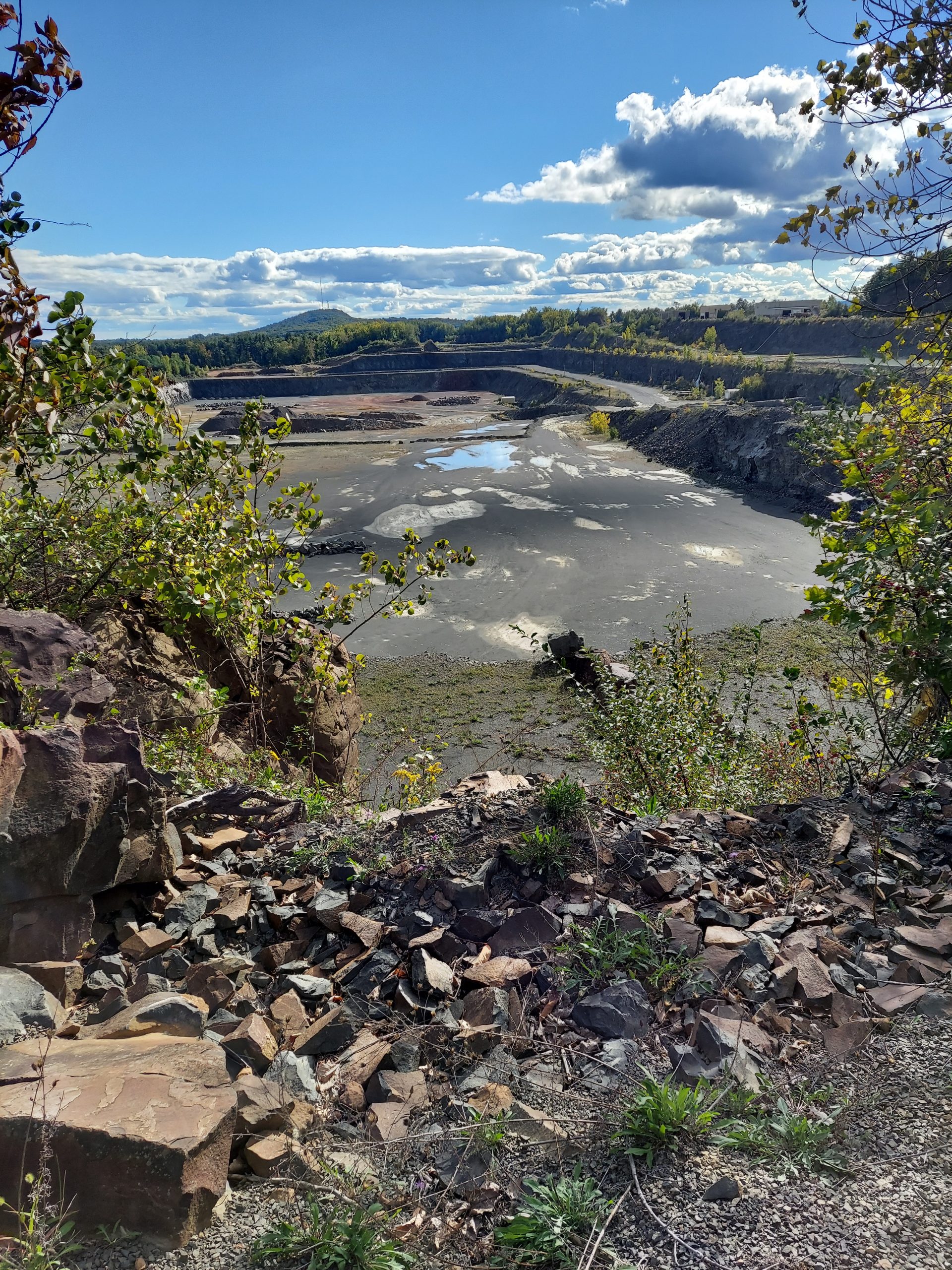
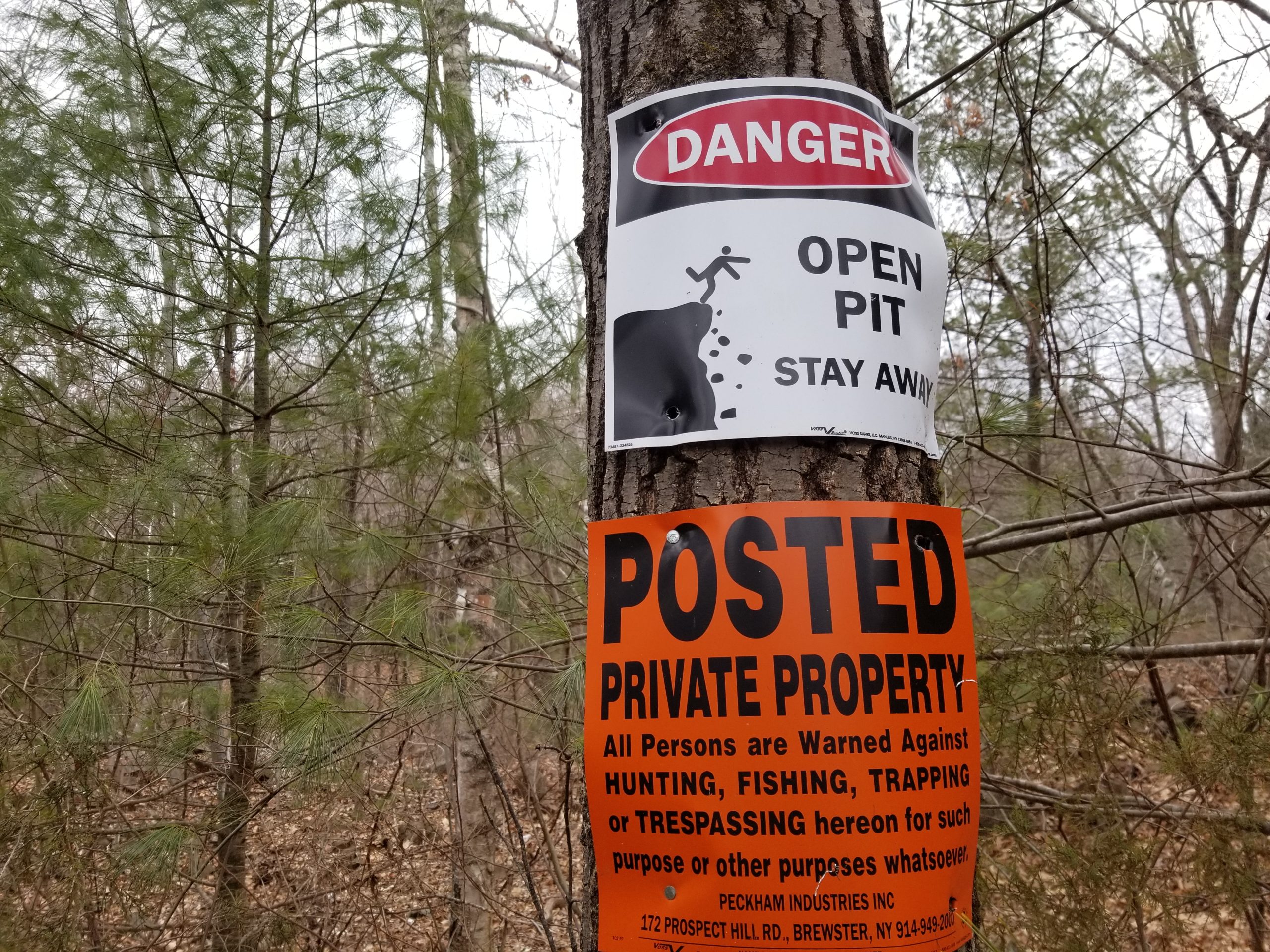
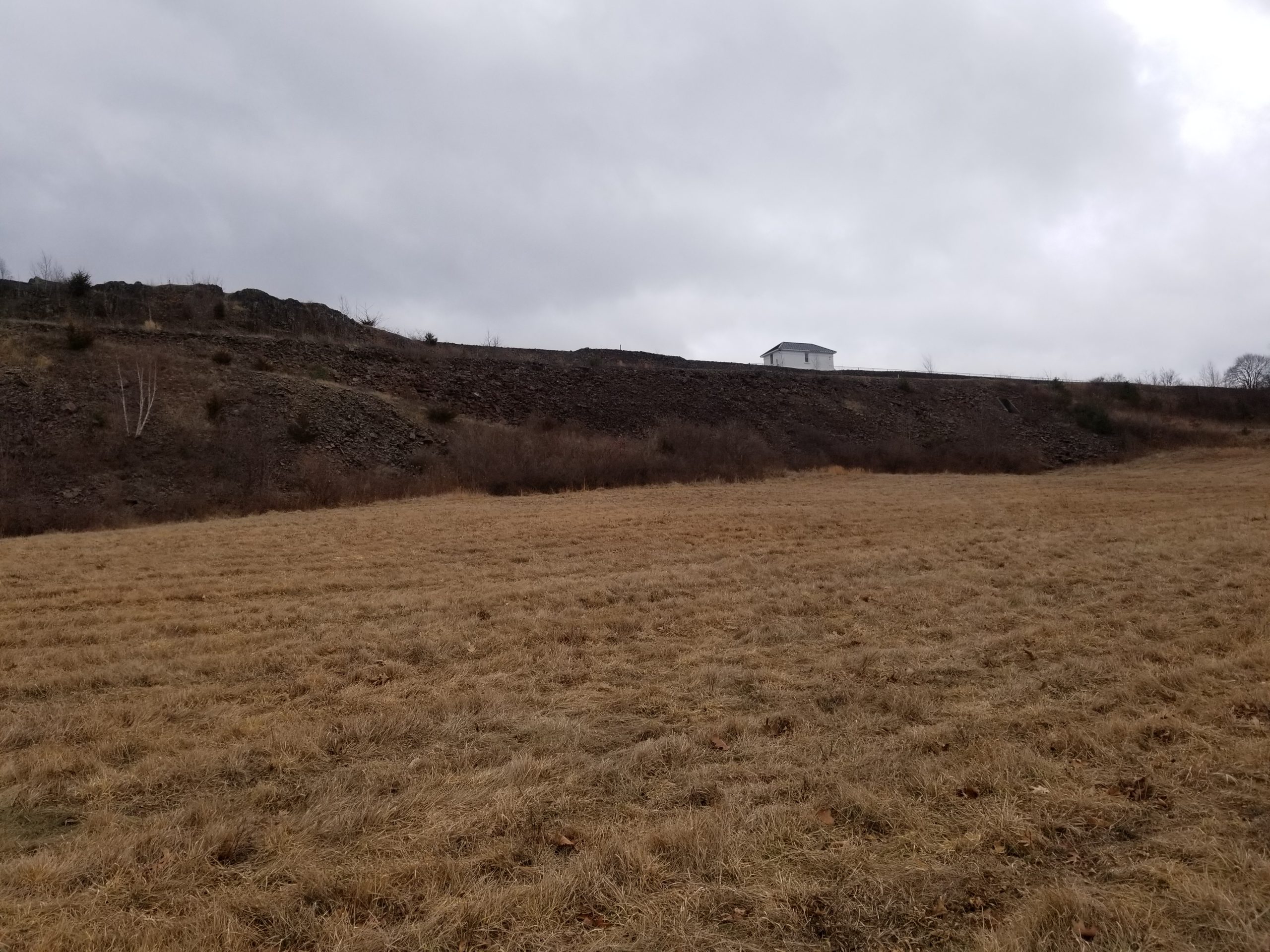
Staying on the trail is recommended! The signs read “Danger Open Pit Stay Away” and “Posted Private Property”
The view to the west.
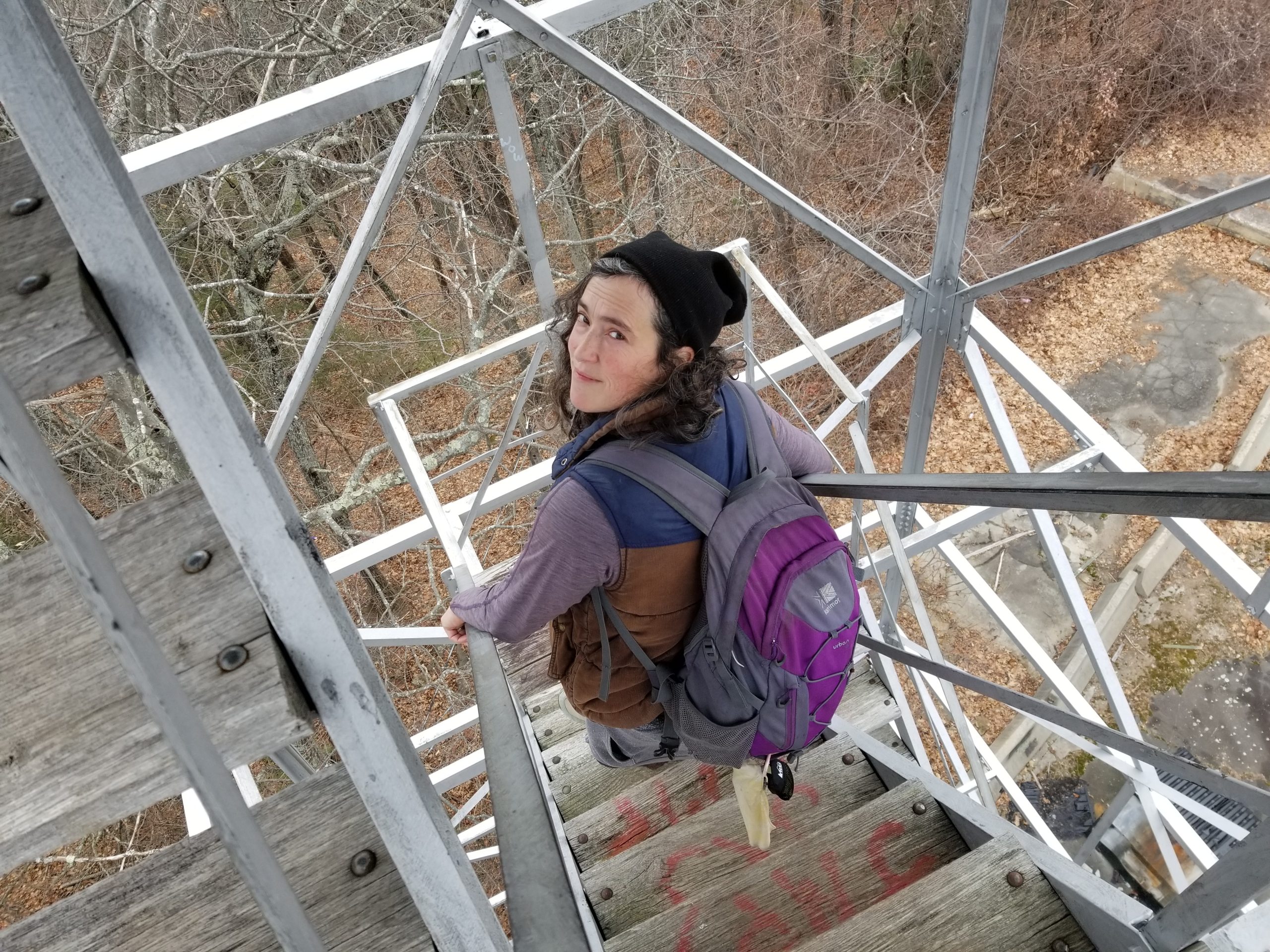
The old fire tower has partially obscured views of the area.
I’ve started a new series of hikes using public transportation leaving from Northampton, Massachusetts. Our third hike will be Saturday, April 15, 2017 – details below. You can also follow the series on the PVPTH Facebook page.
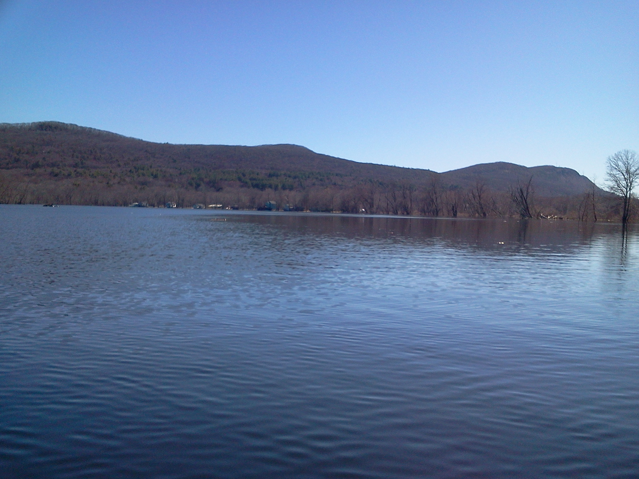
Mt. Tom Range from Rt. 141 to Rt. 5
Mt. Tom range from the Oxbow
Difficulty: Hard – steep climbs, long distance.
Distance: 6.5 miles.
Transit:PVTA R41 (schedule , map) & B48 (schedule, map) from the Academy of Music, 274 Main St, Northampton, MA 01060, $1.25 each way.
Meet Saturday 4/15/17 to catch the 10 a.m. bus at the Academy of Music – we’ll take the R41 bus through Easthampton and get off on Rt. 141 at the top of the hill just after passing into Holyoke. We’ll hike north on the New England/M&M Trail, up over Mt. Tom and along the ridge, heading down after Mt. Nonotuck to East St and then Route 5. We’ll catch the B48 bus back into Northampton by late afternoon.
If you’re coming from Williamsburg, Leeds or Florence, you can catch the R42 bus which becomes the R41 at the Academy of Music.
I’ve started a new series of hikes using public transportation leaving from Northampton, Massachusetts. Our second hike was Saturday, November 14, 2015 – details below. You can also follow the series on the PVPTH Facebook page.
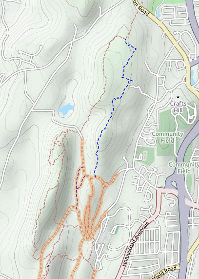
East Mountain & Holyoke Community College Trails
Difficulty: Hard – hills with some steep climbs, navigating unmarked trails. Also difficult to alert the bus driver to the right spot to be dropped off at.
Distance: About 4 miles.
Transit:PVTA R41 (schedule , map) from the Academy of Music, 274 Main St, Northampton, MA 01060. $1.25 each way.
Meet Saturday 11/14 at 1 p.m. at the Academy of Music – we’ll take the R41 bus through Easthampton and get off on Rt. 141 in Holyoke across from the entrance to the Whiting Reservoir Trail Head. We’ll hike south on the New England/M&M Trail, climb the northern end of East Mountain and connect to the Holyoke Community College (HCC) trail system, catching the bus back from HCC at 4:10 pm, arriving in Northampton by 4:50 pm. Blaze orange is recommended as it is bow hunting season for deer.
I’ve started a new series of hikes using public transportation leaving from Northampton, Massachusetts. One of the great things about using transit to get to places to hike is that it’s easy to do one-way hikes – you can get off at one stop and take a hike to another stop, all without requiring shuttling two vehicles. Our first hike was Saturday, October 31, 2015 – details below. Also follow the series on the PVPTH Facebook page.
Mt. Nonotuck, Goat Peak and Lake Bray
The view from Mount Nonotuck
Difficulty: Moderate – uphill on a carriage road, up and down along the ridge, then downhill on trails
Distance: 3.2 to 4.0 miles (1.1 on roads, 2.1 to 2.9 on trails)
Transit:PVTA B48 (schedule , map) from the Academy of Music, 274 Main St, Northampton, MA 01060. Travel time is 10-15 minutes each way. Runs 7 days a week, less frequently on Sundays. $1.25 each way, or $3 for a day pass.
Hiking time: 1.5 to 2.5 hours, depending on speed and how much time you want to spend exploring the Eyrie House ruins