Category Archives: Mapping

Random vacations

The other day my friend Barry and I went on a walk.  At each intersection we flipped a coin.  Heads meant we continued straight.  Tails then we flipped again, and then heads was left, tails was right.

Later that evening a group of friends brainstormed taking random vacations:

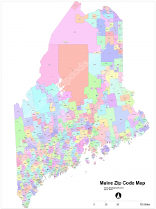
Taken from http://www.aboutzipcode.com

  1. Zip codes.  Roll up to 5 numbers on a ten-sided die (or 9 or 11 numbers depending on how precise you want to be!), and plan a vacation to that zip code.  It might be Smith College (01063), the Northampton Post Office Boxes (01061), Ketichan, AK (99950) or the IRS office in Holtsville, NY (00501)!
  2. Amtrak stations.  Pick a random one and travel by train.
  3. Megabus.  Set a dollar amount you are willing to pay, and figure out the farthest you can travel on Megabus for that amount.  Someone should write a program to help figure this out.  $25 can take you pretty far if you book in advance.
  4. Hitchhiking without a destination in mind.  Just go wherever the rides you get are going!
  5. Follow the wind.  Take a bicycle trip (or sailboat) and always go downwind as much as possible.  Or upwind if you want a challenge.
  6. Follow the money.  Offer your labor to everyone around you and do or go to whomever will pay you the most.  Or least.  You get to decide what your limits are – legal or illegal.
  7. Follow an animal’s tracks.  Once I followed a moose’s tracks in the snow for hours.  They can travel hundreds of miles, so it could be quite an adventure.
  8. On USGS topo maps, each square kilometer is outlined.  Pick one of these, and spend a day exploring it.
  9. Visit a random intersection of integer degree latitude and longitude lines, such as 42°N 73°W.  Who would want to do that? 12,832 so far with the Degree Confluence Project.

Why are these kinds of things interesting to me?  I think it creates an opportunity to break away from my ordinary routine and thinking.  Who knows what will happen en route or who I will meet?

In October I have two weeks off.  Maybe I’ll pick one of these – which one do you think I should do?

Walking journey 2015

UPDATE: Listen to the radio show of the first five days of my walk!

I’m going on a walking journey from April 17 to 25, 2015, around Western Massachusetts and possibly into neighboring states.  I’ve created a website to help me plan the route and find hosts at journey.sharett.org.

Last April I spent four days walking from my house to western Florence, Huntington, Easthampton, Mass. and back home – about 35 miles 2014-04-17 13.53.36total.  Each night I spent with a different friend, and each day I walked, sometimes with friends, sometimes meeting new people along the way, sometimes being barked at, mapping new trails and roads that I found and adding them to Open Street Map. Most of the time I was off of major roads, walking old woods roads and sometimes bushwhacking through fields, forests and the occasional swamp!
This year I’m not quite sure what the journey will bring, but I’m looking forward to meeting new people and seeing the beauty of the early spring.

My route is mostly set, but I’m still looking for a host in Williamsburg, MA.  If you’d like to host me for a night, visit journey.sharett.org and fill out the form at the bottom of the page, or contact me.

If you’d like to walk with me for part of the journey, or want me to deliver letters to people along the route, be in touch!

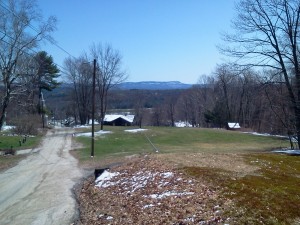
Here are some pictures from last year’s journey:
2014-04-16 12.10.58

2014-04-16 14.27.38

Mapping my city with Open Street Map

Over the last few months I’ve been mapping the hiking trails and off street paths of my city, Northampton, Massachusetts, using Open Street Map, a free world map that anyone can edit.  My Sundays have often been going out hiking with friends in the Sawmill Hills of Florence, recording my tracks with a GPS.  There are miles of paths and every time I go out I discover another new to me path heading off that I mark to map later.  I especially enjoy walking through the hills to visit friends on the other side – walking through the woods to a fun destination is the best!

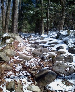
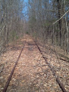
My dream is be able to walk pretty much anywhere on trails and back roads.  A couple of weeks ago I walked to my friend’s place in Huntington, Mass. on trails and back roads like this one, which is Spruce Hill Rd in Westhampton.  Just the kind of “road” I like:

Spruce Hill Rd in WesthamptonAll that needs to happen for my dream to be realized is for the many trails and paths that already exist to be mapped – if you have a smart phone with a GPS in it (most do), you can explore the trails near you, and add them to Open Street Map.  (For Android, you can use My Tracks).

P.S. 7/12/14: Since writing this post, I discovered the Strava heat map of the Sawmill Hills. Strava compiles all of their customers’ running and biking journeys into one map, allowing you to see where many trails are.  You can use it to edit Open Street Map as well.